


Will We See A New State Border in Our Lifetime?
For many American citizens today, our state borders have been seemingly well-defined throughout our lifetime — but that doesn’t mean it has always been this way or that it always will. In fact, the Indiana-Illinois border could change even sooner than we might think. Indiana House Bill 1008, which would restructure the border between the […] The post Will We See A New State Border in Our Lifetime? appeared first on 24/7 Wall St..
For many American citizens today, our state borders have been seemingly well-defined throughout our lifetime — but that doesn’t mean it has always been this way or that it always will. In fact, the Indiana-Illinois border could change even sooner than we might think. Indiana House Bill 1008, which would restructure the border between the two states, was recently amended by the Senate Public Policy Committee. The bill comes after several Illinois counties — Iroquois, Calhoun, Clinton, Greene, Jersey, Madison and Perry — voted to secede from the state in November 2024, citing cultural and political differences with the larger cities and stating that their interests were not being upheld. A similar bill, House Bill 1500, was also presented in Illinois. Should this happen, Indiana would absorb a total of 33 counties out of Illinois’ 102 counties. Whether this will actually be implemented has yet to be seen. (Which states could survive on their own if they seceded from the union?)
Historically, borders have been set, broken, reset, and changed again. You might look at a map today and wonder how any of our states were actually set up — and why Kentucky was able to claim that non-contiguous area in its western corner. But understanding the borders provides a great overview of how the United States, trade, and community relationships operate. Here, 24/7 Wall St. decided to find the strangest U.S. state borders and explore how those borders were established. To do so, we used a variety of sources, including historical maps, the Library of Congress, and a variety of books such as Mark Stein’s How the States Got Their Shapes, Tegan and Jerry Hansen’s State Boundaries of America, and Howard Caulfield’s The United States of America: State Borders and Other Facts.
This previously published article was updated on April 8, 2025 to highlight the heightened possibility of redone state borders between Illinois and Indiana.
Why We Must Discuss Borders Now
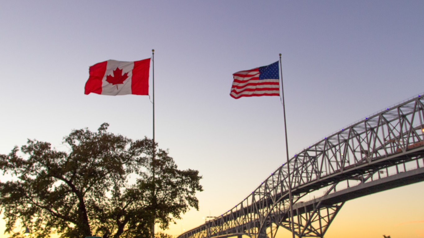
At first, you might not think of state borders as very exciting — but you’d be wrong here. Odd boundaries exist between U.S. states and our neighboring countries, Canada and Mexico. These borders reflect our history: the conflicts, geographies, and occasional compromises we went through in setting up our country. The United States and Canada are currently clashing over a move that would undoubtedly change the border: Trump’s insistence that Canada should become the 51st state. However, a majority of people are not supportive of this move — and this could complicate or destroy U.S.-Canada relations for years to come.
Border changes between states can be annoying — for one, you can get in big trouble for carrying a gun across state lines if you’re not legally allowed to possess the gun in both states — but when our international borders are out of whack, it can become a crisis. The borders between states also represents an economic challenge. In many cases, borders were drawn without a great regard for natural landscape or existing economies — though, at the time they were created, there was no trade network or business setup like there is today.
Check out the strangest state borders across the United States:
Alaska-Canada
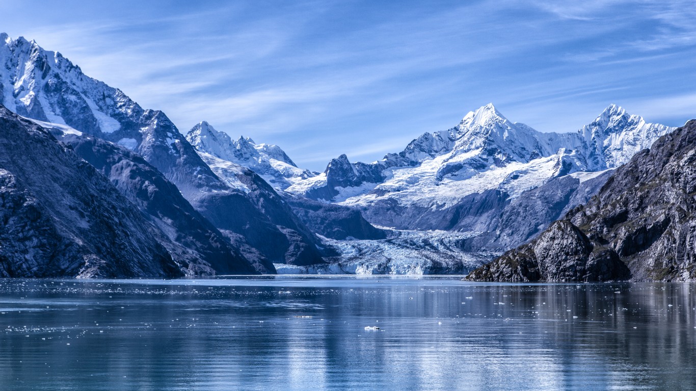
Alaska’s southern panhandle is attached to the rest of the state by a narrow neck of land. This is the furthest south the Russians could claim before the British claimed the rest of the mainland around them. After the U.S. bought Alaska and began negotiating the final border with Canada, the Canadians wanted to get at least part of it to have a Pacific port for the Yukon Territory, where gold had been discovered. But the British, who controlled their foreign policy, went along with U.S. claims to keep the area because they wanted better relations and cooperation in other areas that were more important to them, like the Caribbean.
Minnesota-Canada
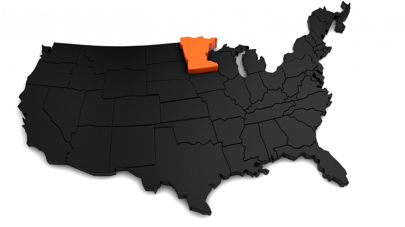
The Northwest Angle is a distinct region on Minnesota’s northern border that juts into Canada. The “Angle,” as its known by its 149 residents, is just a small corner of land attached to a peninsula on the Canada side and separated from the United States by the Lake of the Woods. The Northwest Angle exists because the U.S. and Britain signed treaties recognizing U.S. independence and the boundaries of the Louisiana Territory before this area had been completely explored. The language of those treaties created this anomaly. Although Canada and Britain tried to purchase this little chunk of land to clean up the border, the U.S. refused to sell it because it would change the revered treaty in which Britain had recognized U.S. independence. The border was reaffirmed in the Webster-Ashburton Treaty of 1842.
Texas-Mexico
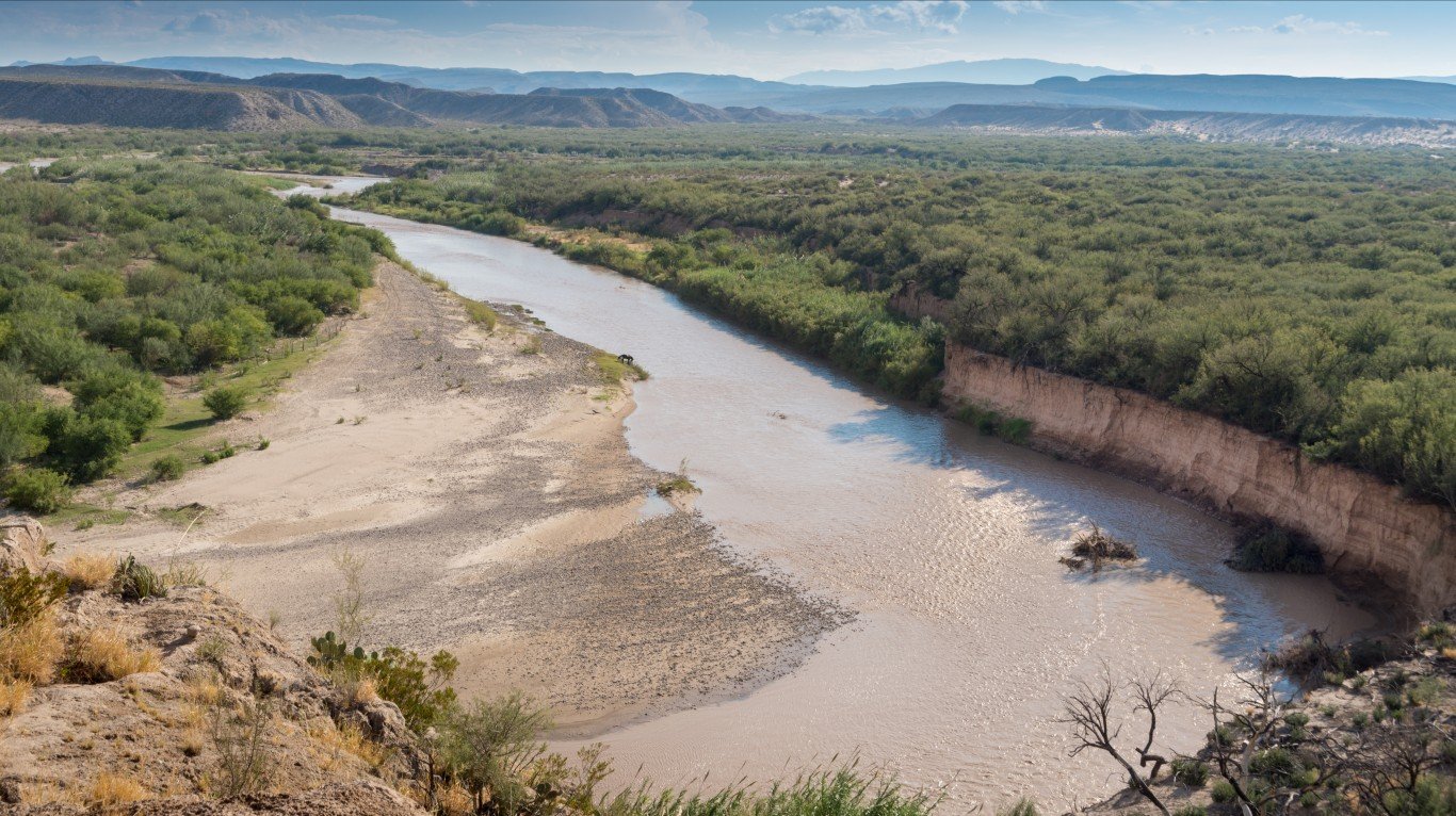
The Rio Grande acts as a natural border between Texas and Mexico. However, since the river occasionally shifts courses, pockets of land become stranded on the wrong side of the border. In 1970, Mexico and the United States signed the “Treaty to Resolve Pending Boundary Differences and to Maintain the Rio Grande and the Colorado Rivers as the International Boundary” (more simply known as the 1970 Boundary Treaty). This treaty transfered several small tracts of stranded land to Texas and Mexico, and dug new channels for the river to return to its historic location. The two countries shared equally in the cost of this border revision.
Florida
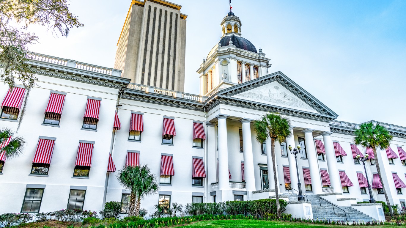
The Spanish colonized Florida and extended its northwestern panhandle all the way to the Mississippi River. Unable to manage and defend all its territory, Spain sold Florida to the U.S. in 1819 through the Adam-Onis Treaty. The Spanish population was concentrated across the northern part of the state between Pensacola on the Gulf of Mexico in the west and St. Augustine on the Atlantic Coast. Everything west of Pensacola was transferred to Louisiana, Mississippi, and Alabama to make sure they all had access to the Gulf of Mexico. The majority of the Spanish population was kept together in the one state of Florida. The state capital, Tallahassee was chosen as the midway point of the population centers of that time.
Idaho
If Idaho looks like Montana broke through and gobbled up about a third of it in the northeast, well — that’s because it did. Gold was discovered in the mountains to the northeast. Instead of creating a straight-line border or a line that followed the Continental Divide, Montana politicians successfully lobbied in Congress (reportedly by privately giving strategic Congressmen substantial “samples” of gold) to ensure the border was drawn with the gold deposits on the Montana side. Meanwhile, Idaho got some very nice potato lands. (It’s kind of fair. I mean, both sides got something they could dig up out of the ground, right?)
Iowa
The town of Carter Lake, Iowa sits on the Nebraska side of the Missouri River, jutting into the eastern part of Omaha. It’s partially surrounded by a bow lake that is all that remains of the loop of the Missouri that once defined the border. The town has made some efforts in the past to be annexed to Nebraska but this never materialized. Today many Omaha-area residents drive through Carter Lake (Iowa) to take the fastest route to the Omaha airport.
Kentucky
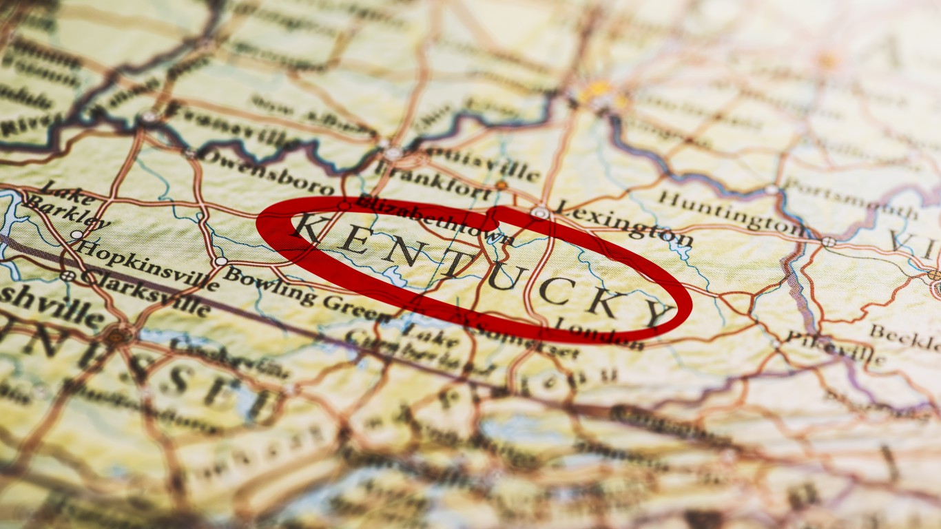
If you look closely at the farthest western part of Kentucky, you’ll find the Kentucky Bend, a peninsula with the Mississippi River and the state of Missouri on three sides, separating it from the rest of the state. The Kentucky Bend is accessible by land only from the south via Tennessee. It’s the result of the shifting course of the meandering Mississippi River, which cut this area off from the rest of Kentucky. As of the last census in 2020, just nine people lived there. Essentially, no one is motivated to do anything about it.
Maryland
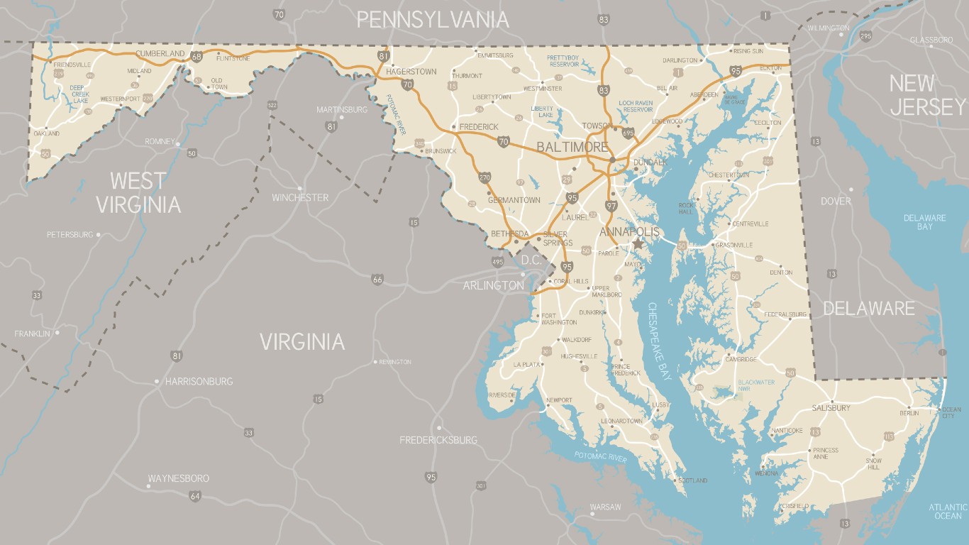
No offense intended to the good citizens of Maryland, but this state looks like a left-over scrap after everybody else took bites of it. And that’s more than a little true. Virginia was founded earlier, to the south of the Potomac. Sweden started a colony on the Delaware River that was later taken over by the Dutch and then the British before becoming the nucleus of the colony of Delaware. Britain doled out a charter to start Pennsylvania to the north and later established the Mason Dixon Line as its southern border.
By the time, Delaware and Virginia got their pieces of the Delmarva Peninsula and the Pennsylvania and Virginia borders were extended west. Maryland was left with an narrow peninsula only one mile wide at its narrowest point. The three westernmost Appalachian Maryland counties there today have recently begun agitating to join West Virginia, with which they have more in common culturally and politically.
Michigan
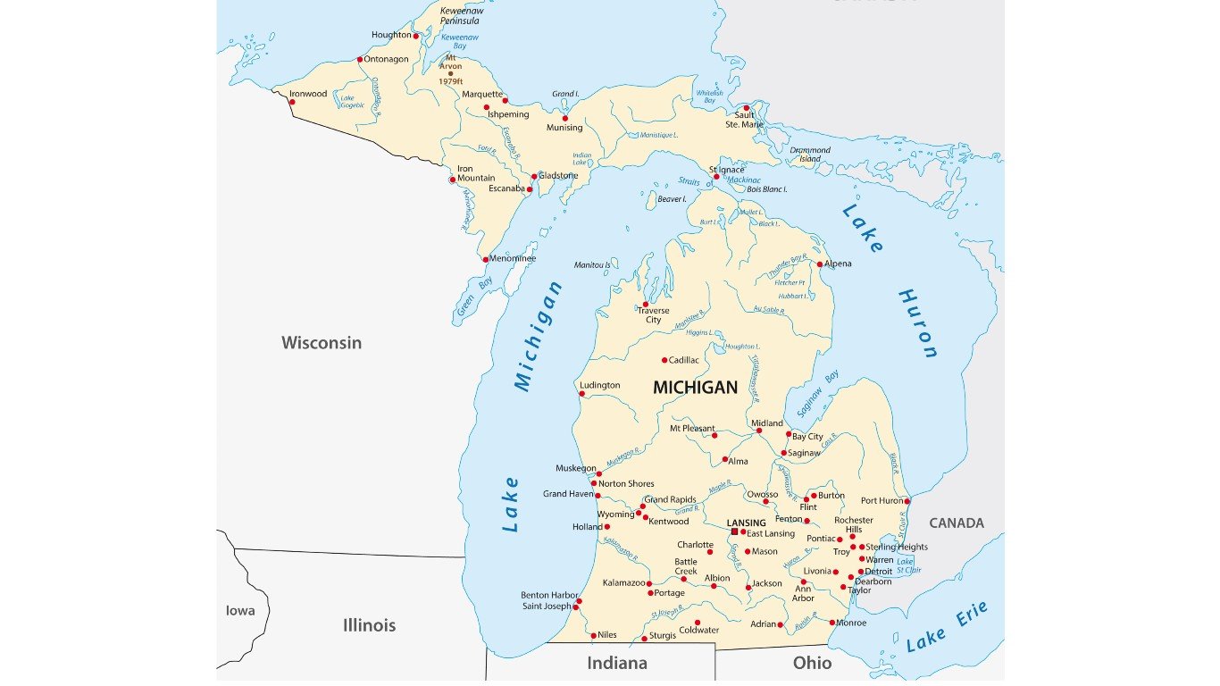
Michigan has a lower peninsula and an upper one, separated from the rest of the state by the Great Lakes, but attached by land to Wisconsin. Michigan and Ohio had a dispute over the city of Toledo. Michigan agreed to give up its claim in exchange for the empty but resource-rich upper peninsula.
Oklahoma
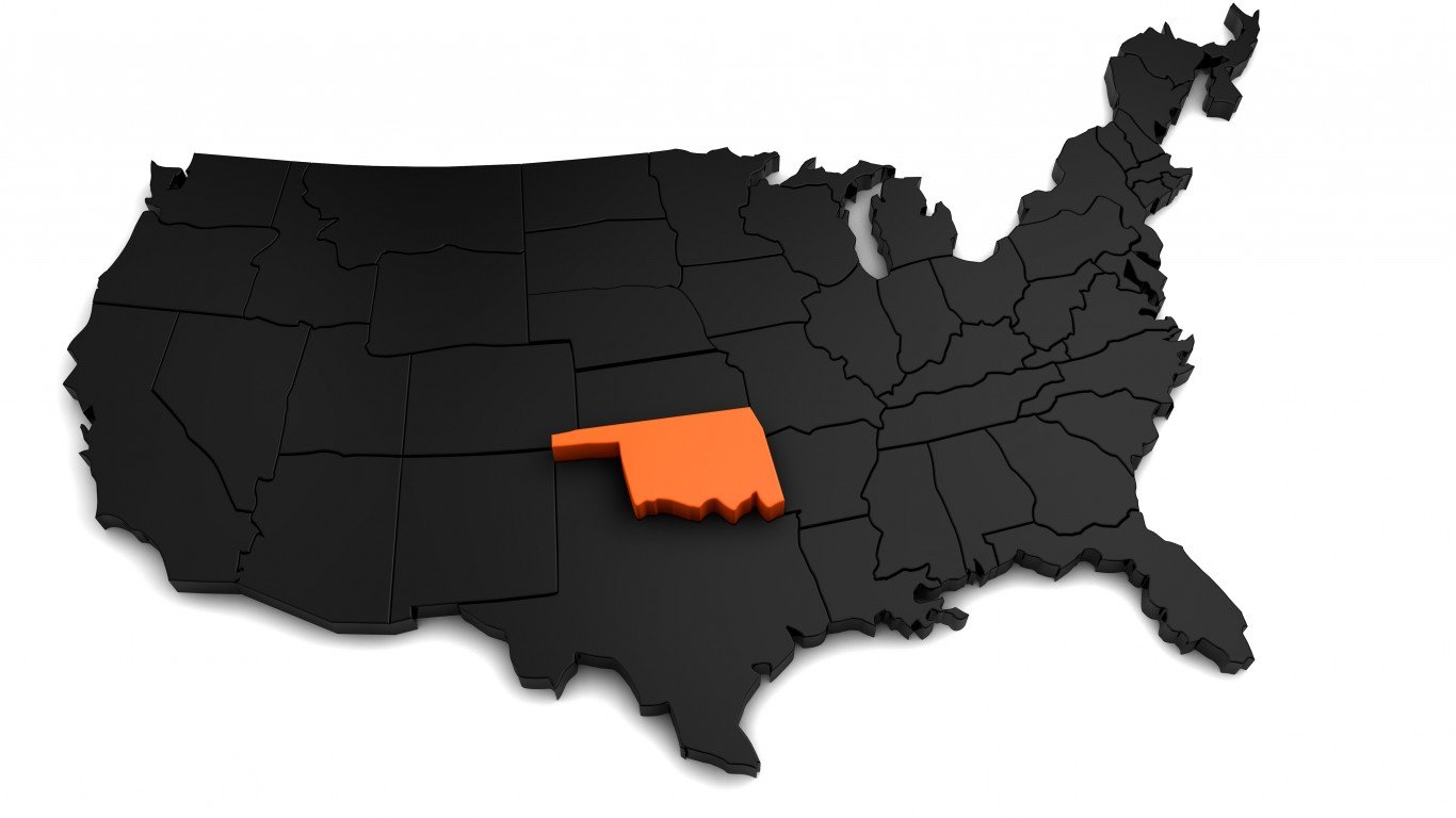
Oklahoma has a narrow panhandle to the West that was once part of Texas. The reason it was detached from Texas was that it was further north than the northernmost limit the federal government permitted for slave states like Texas.
Virginia
The Eastern Shore of Virginia is the southern tip of the Delmarva Peninsula on the east side of Chesapeake Bay. This came about because the British decided to extend the Virginia/Maryland border from the mouth of the Potomac River across the Peninsula. Eventually, this gave the larger colony of Virginia control of both sides of the mouth of the Bay, a longer Atlantic Coastline, and control of the fishing in the southern half of the Bay.
West Virginia
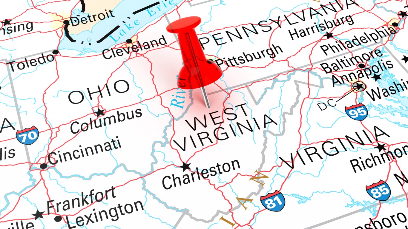
West Virginia has an unusual panhandle protruding to the east because the state was formed out of Virginia counties that were opposed to secession from the Union. Appalachian counties in the western part of the state had economic and cultural ties to Pennsylvania and Ohio and did not want to fight for slavery that benefitted wealthy plantation owners in the coastal Tidewater region of the state. The panhandle itself includes Virginia’s formerly northernmost counties that did not sympathize with slavery.
The post Will We See A New State Border in Our Lifetime? appeared first on 24/7 Wall St..